|
Good afternoon everyone, Looks like we got another system coming into the area this evening and over night once again. Here is what we know. 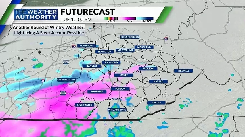 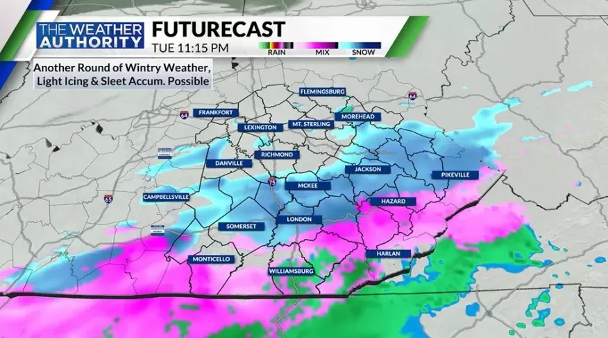 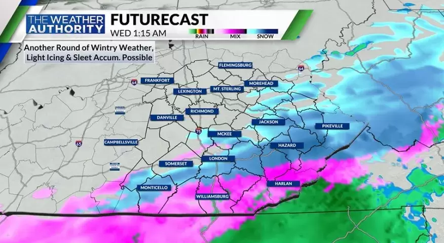 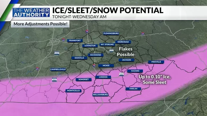 When more information comes in we will update right here. Have a great one eveyrone.
Red Vinyl
0 Comments
 Isolated instances of freezing rain are possible for some early this morning, otherwise widespread rain is expected today. Scattered snow showers are then possible into Monday. Another system arrives into mid week, bringing rain and a transition to some wintry mix through Thursday. 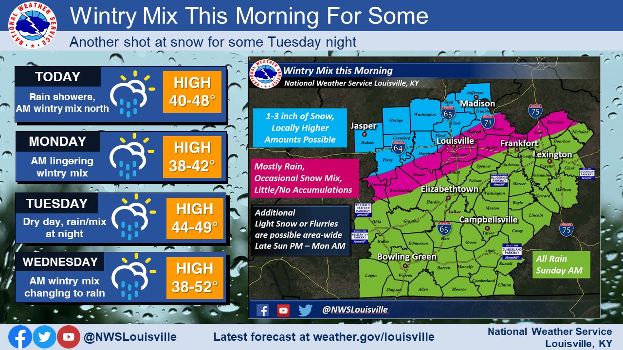 Many spots in Indiana will see 1-3 inches of wet snow accumulations. An isolated area or two could see slightly more. Have a great day everyone.
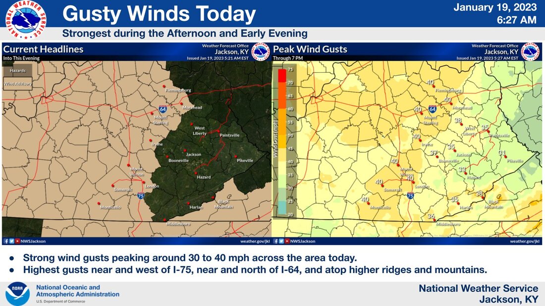 Good afternoon everyone,
Looks like the windy weather is making a return. Strong wind gusts expected, especially this afternoon and early evening. Hang in there everyone. 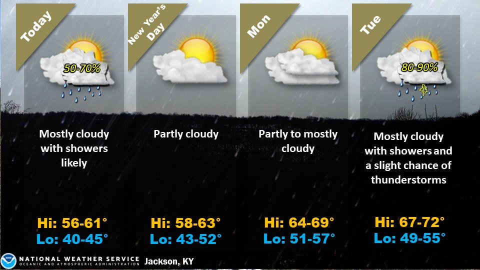 Rain showers will be likely across the area today, as an upper level disturbance and low pressure system pass through the Ohio Valley. Dry weather will return briefly for New Year's Day. Another storm system will approach the area again by late Monday, bringing another round of rain to the area Monday night through Wednesday. Well above normal temperatures will continue through the period.
Mostly clear skies, light winds, and dry conditions are on tap for the residents of eastern Kentucky today and tonight. A passing, albeit weak, cold front will push through the area Monday and Monday evening, bringing isolated showers and storms to eastern KY. Dry and warmer weather is expected for Tuesday, as high pressure settles back over the region. 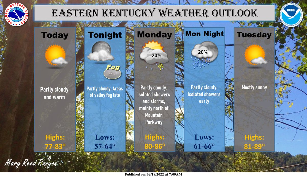 A round of record breaking heat is expected to build across the area for the first half of next week. A very strong high pressure ridge will limit any precipitation chances and most places will see very limited cloud cover for any sort of relief. Be prepared for the upcoming heatwave and be sure to check on family members, neighbors and pets as the heatwave gets underway! 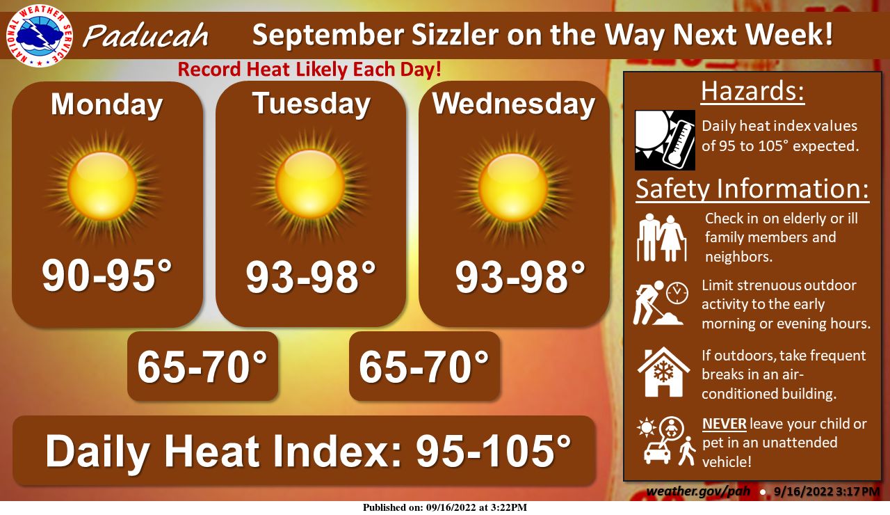 Have the best rest of your weekend and take care of each other too.
A slow moving upper level disturbance and frontal boundary will bring several rounds of showers and storms through the extended weekend. Here is the current rainfall outlook, with isolated instances of flash flooding possible through Labor Day. 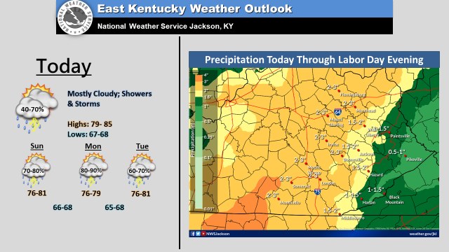 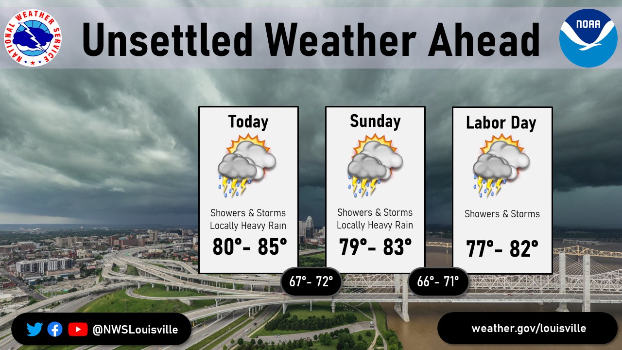 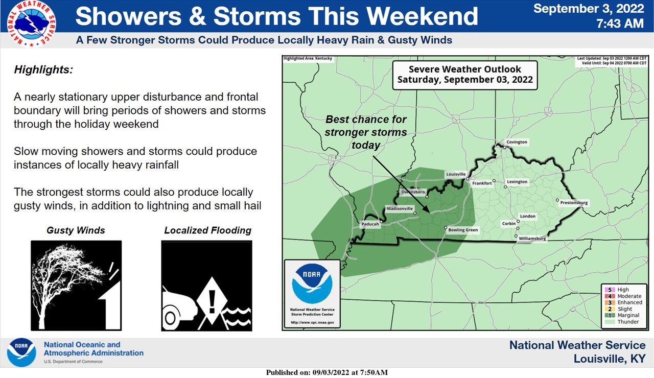 Have a great weekend out there and take care of each other.
Good evening out there, I know it's been a while posting here and I am very sorry about that. I have forgotten about doing so. I will try to get back into it. Here is what we know: 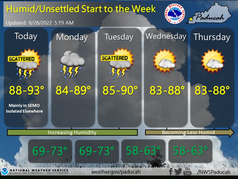 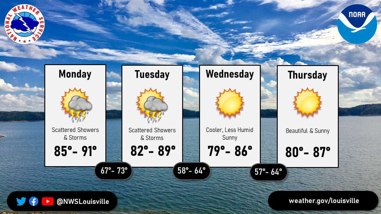 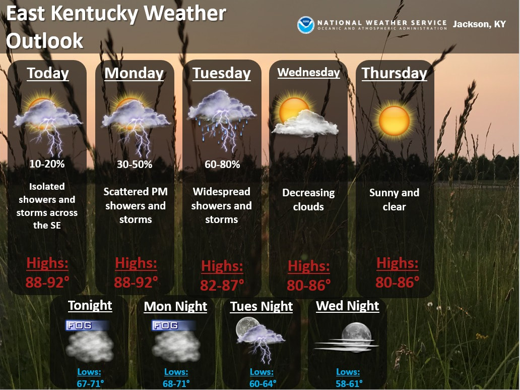 Have a great evening everyone and take care of each other out there.
A cold front will slowly track into the region today. This will bring widespread showers and thunderstorms to the forecast area through early Tuesday morning before high pressure builds in for Tuesday afternoon. 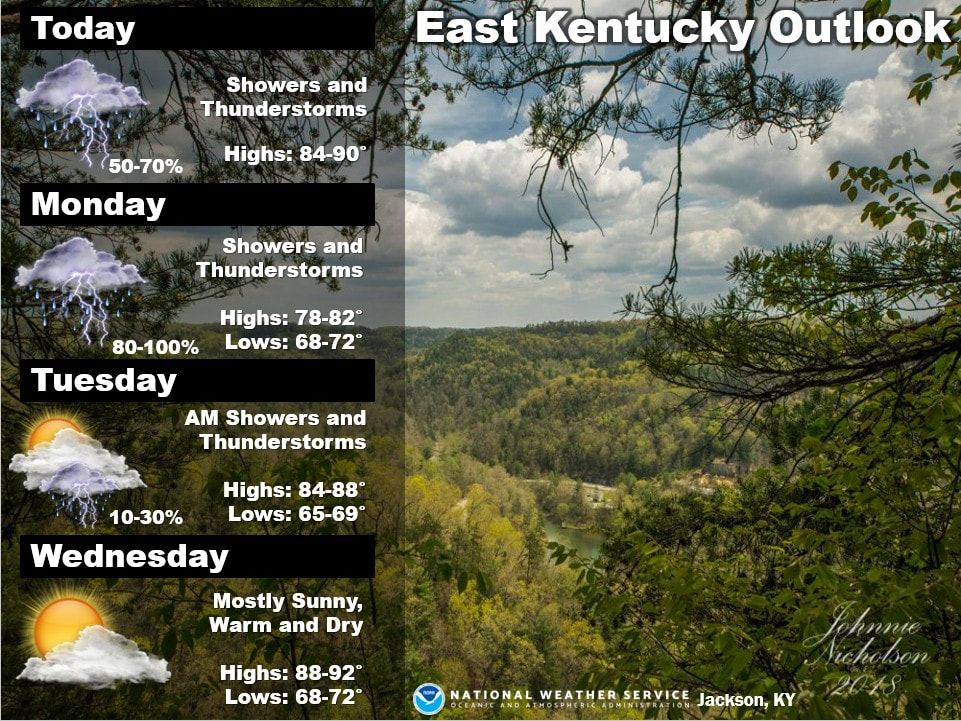 Beneficial rains will spread across the region beginning late tonight and continuing through the end of the weekend. Widespread rainfall amounts of 0.5 to 1.5 inches are expected, with locally higher amounts up to 2 inches possible. An isolated strong storm is possible across SE MO into W KY Sunday afternoon and evening. 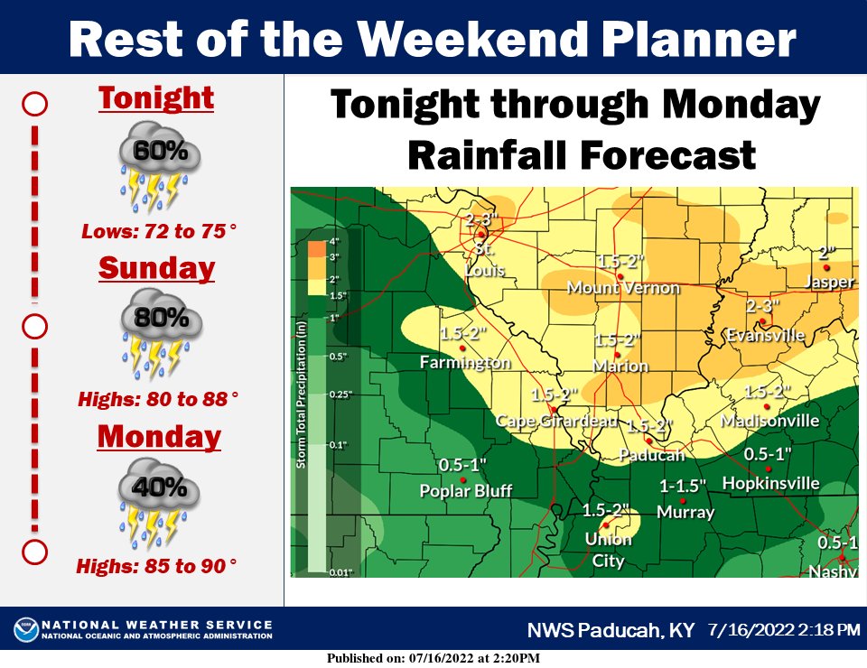 Intervals of showers and storms today and Monday, with locally heavy rainfall possible. Dry but turning hot Tuesday, with 100+ heat index possible Wednesday. 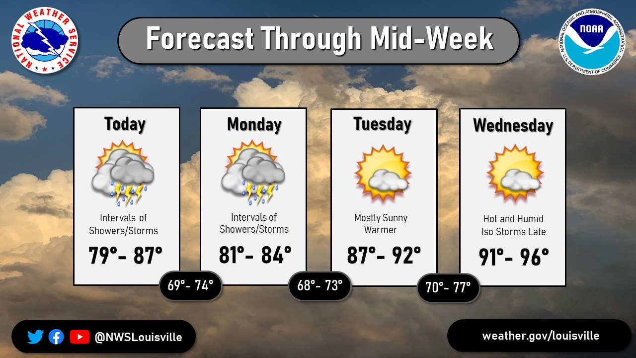 Have a great day everyone.
Nice weather will be in place for the end of the weekend. More sunshine, less humidity and pleasantly warm for your Sunday with afternoon highs ranging from the low to mid 80s. The combination of clear skies and light winds will give us a comfortably cool overnight as lows drop into the low to mid 60s with some of our more urban areas closer to 70. There is also a chance of some patchy morning fog for Monday morning. We start the week with warmer temperatures and increasing humidity as we remain sunny. Highs to start the week will be closer to 90. Out next chance of scattered showers and isolated storms come on Tuesday. 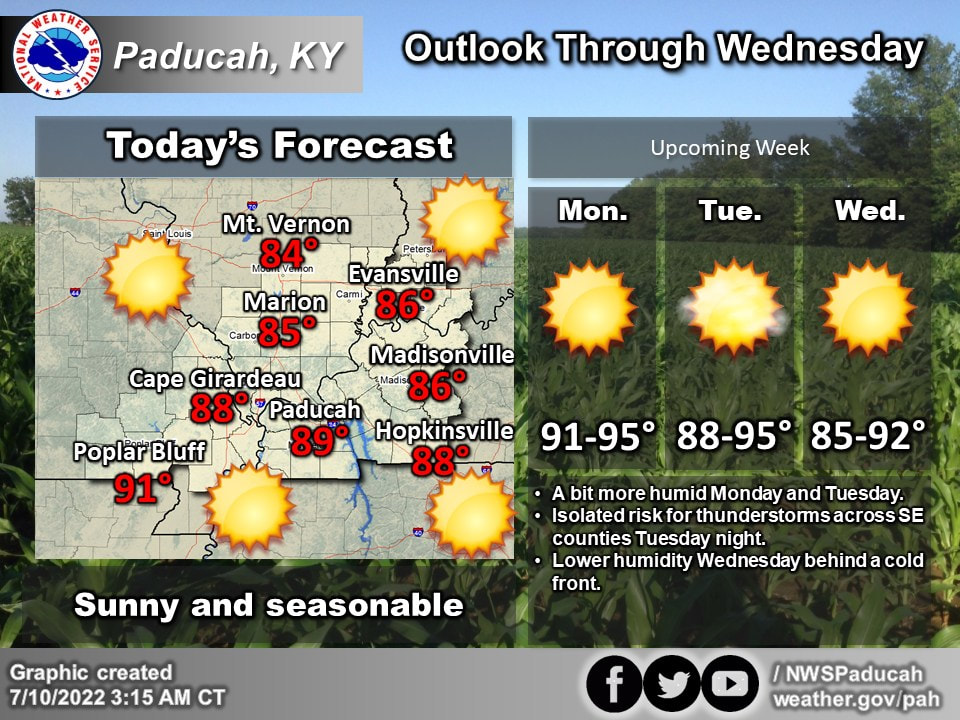 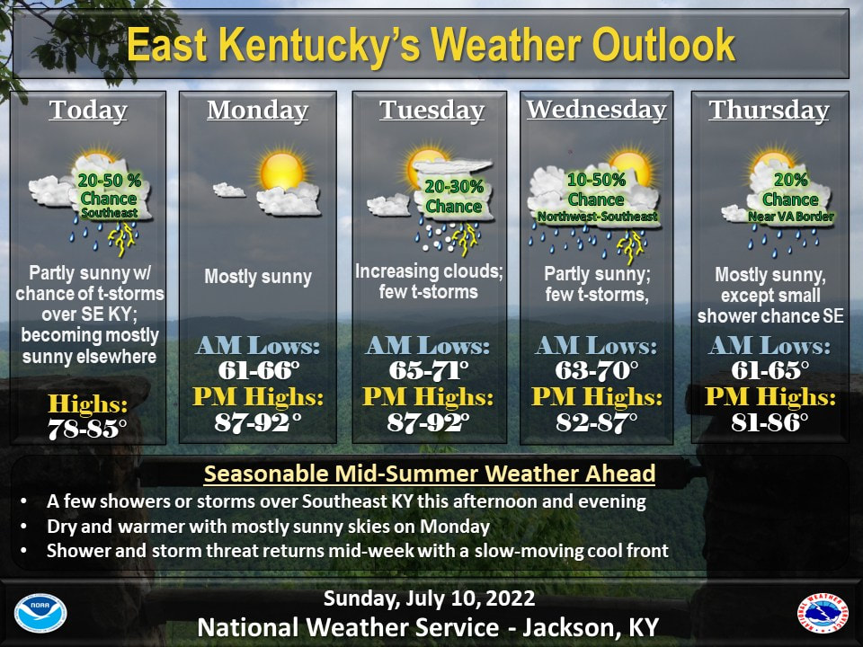 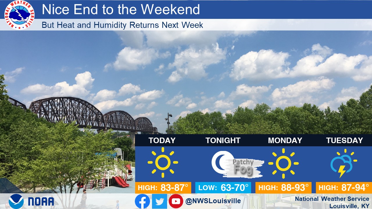 Have a great rest of your weekend everyone, remember to take care of each other out there :)
A slow-moving cool front will keep the threat for showers and storms in the forecast as it settles across eastern Kentucky this weekend. A cold front will bring scattered storms to the region today. Some storms may produce gusty winds and heavy downpours, especially this afternoon and early this evening southeast of a Bowling Green-Lexington line. A few severe storms with damaging winds will be possible this afternoon, mainly over west Kentucky. Locally heavy rainfall and lightning will accompany all thunderstorms today.   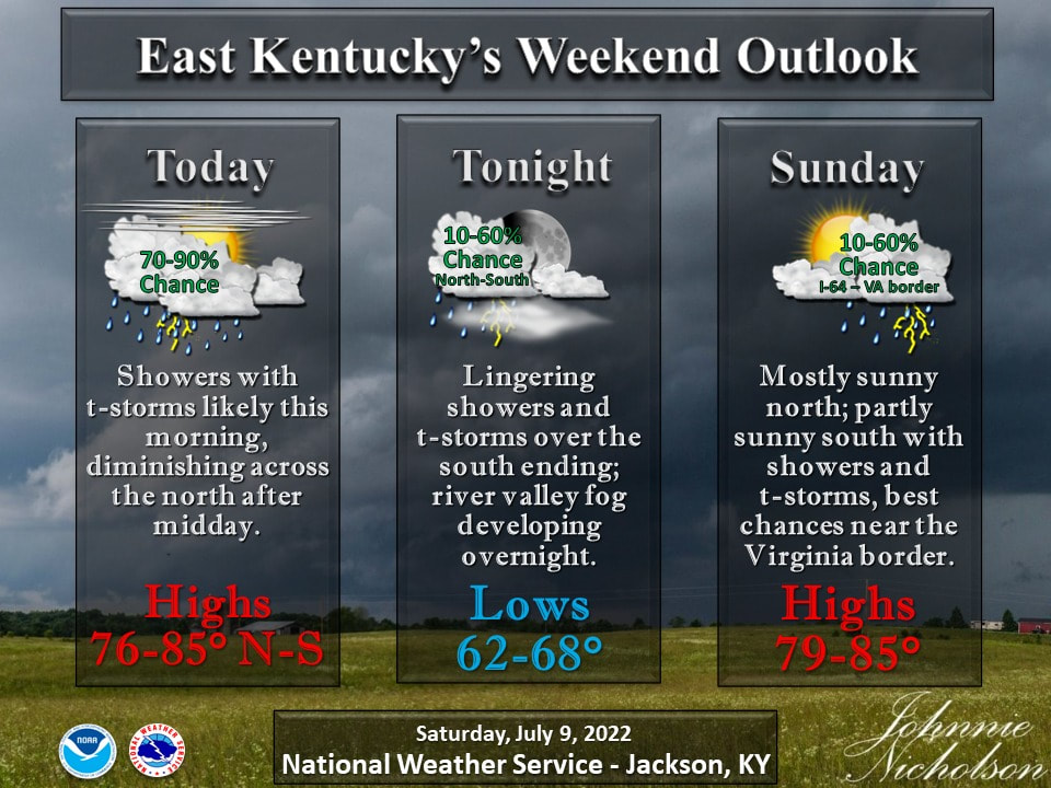 Please be safe out there today and take care of one another.
|
AuthorEverything you need to know about the weather right here, with each post we will keep you up-to-date with all the weather. Archives
January 2023
Categories |
 RSS Feed
