|
Good Morning,
Looks like we have another system coming into play in the Gulf that will bring us more weather problems into the area tomorrow afternoon. We will keep you up-to-date when this should happen and more as it approaches our area.
0 Comments
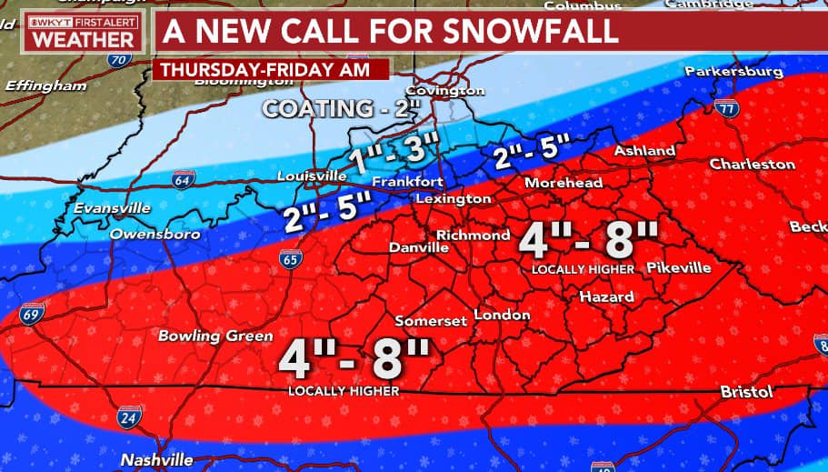 Hello Everyone, here is the latest in the total's for Kentucky! Like I said that with the warning, they would add more counties into it and they did. NOW let's see how much we all get with all these total's. 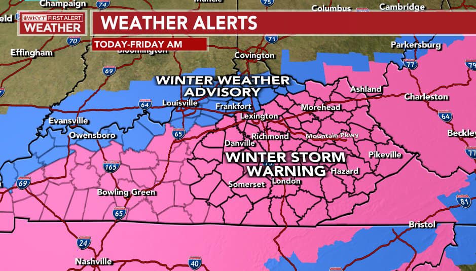 Update 11:55 AM EST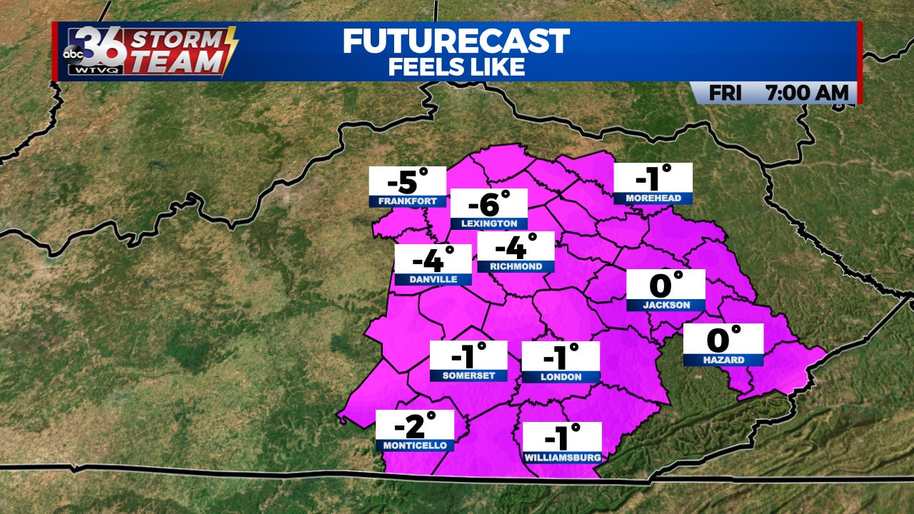 Good Afternoon,
These will be the temps as of Tomorrow morning after the storm! Winter is Here people! UPDATE: As of 2:30 PM EST, our chance of snow is now 6 to 11 Inches. 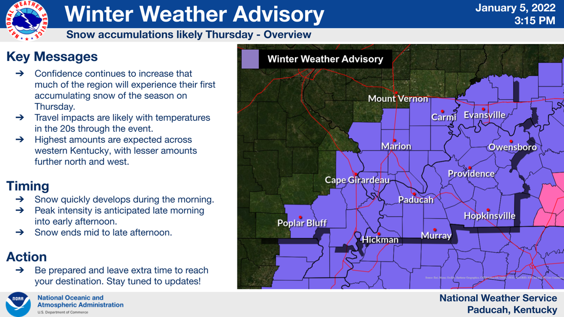 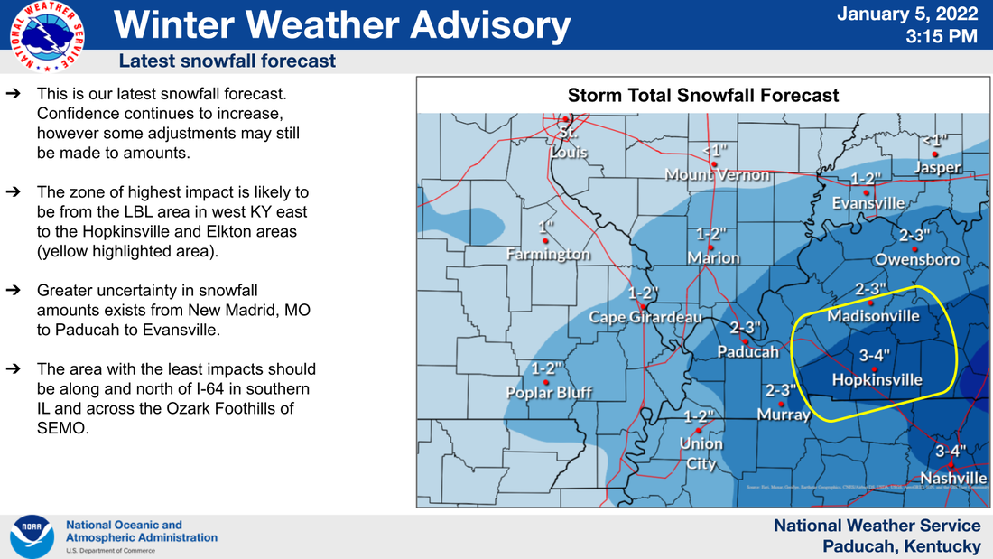 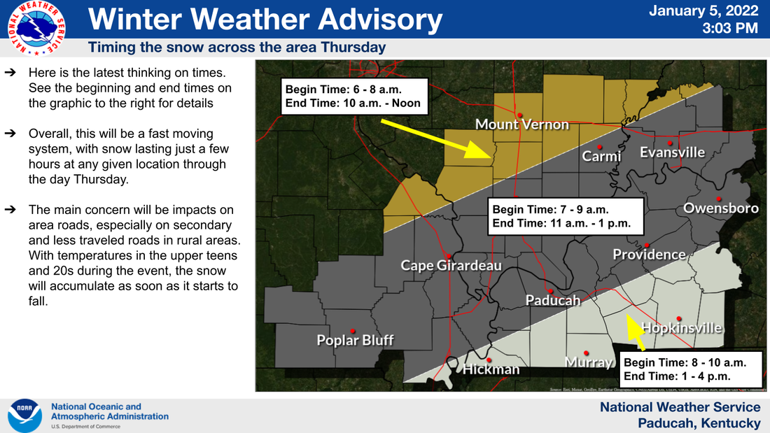 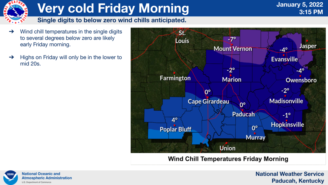 Good Afternoon,
This was just a few minutes ago from the National Weather Service in Paducah, and here you can see the timing of when the storm will be hitting and the impact of the storm. Keep tuned here for the latest. -Red Vinyl 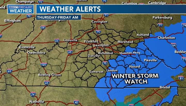 Here we go, it's beginning and these will become more as the evening and early morning happens. Stay with us. We will keep you up-to-date. 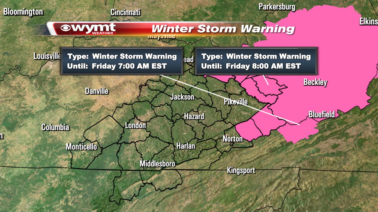 These are the Warnings as of 3:15 PM EST. We will see more too as the storm gets closer to these areas. Update: 3:45 PM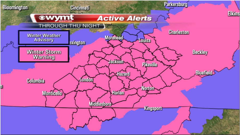 Good Afternoon, here is a Update: These are current as of 3:45 PM EST. Told you they would up the counties on this as the evening progresses. Keep your eyes here for more. Update: 4:20 PM EST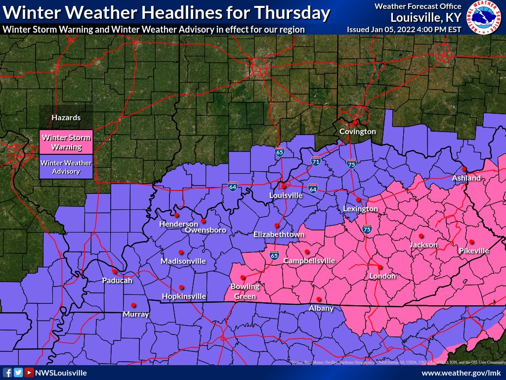 UPDATE AS OF 4:20 PM EST, as you can see, we are just outside the border of the Warning, I feel that we will be added to the Warning later this evening. Stay tune, we will keep the up-to-date. -Red Vinyl
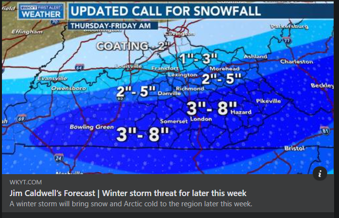 Good Morning, This is from WKYT and I think this is clear! We have snow coming into our area and all over Kentucky. You will think this is going to be it right? 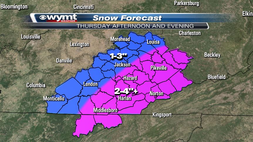 But then WYMT posted this just two hours ago. I see a pattern here don't you? Some of these don't match, and that is telling if you know me? This could be bad. We'll keep you up-to-date as this unfolds.
RED VINYL 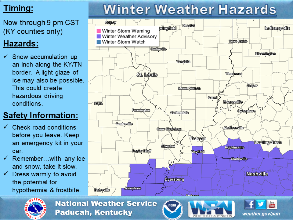 A large weather system centered along the Southeast Gulf Coast States will bring some wintry precipitation to parts of the Quad State region, mainly across west Kentucky. A Winter Weather Advisory is in effect for part of Graves, an all of Calloway, Trigg, Christian and Todd county through 9 pm this Sunday evening. Accumulations of snow up to an inch will be possible, especially along the Kentucky and Tennessee border. Persons traveling or living in the Winter Weather Advisory area should be watchful for changing road conditions due to the snow. A minor glazing of ice may also be possible. Allow extra time to reach your destination and do not travel faster than the conditions allow. Be watchful for travel on elevated surfaces, such as bridges and overpasses, as they may cool and freeze more rapidly. Persons living or traveling in the area north of advisory, but south of a line from Poplar Bluff Missouri, Goreville Illinois, Evansville an Rockport Indiana may see a very light mix of rain, freezing rain, an snow, but travel impacts should be minimal north of the advisory area. In addition, Wind chills will remain in the teens an twenties today, gradually falling into the single digits an teens tonight. Anyone venturing outdoors should dress warmly and in layers to avoid the impacts of hypothermia and frostbite. Be sure to check on your neighbors that may be without heat, as well as those that must venture outdoors for work or travel today and tonight. Update: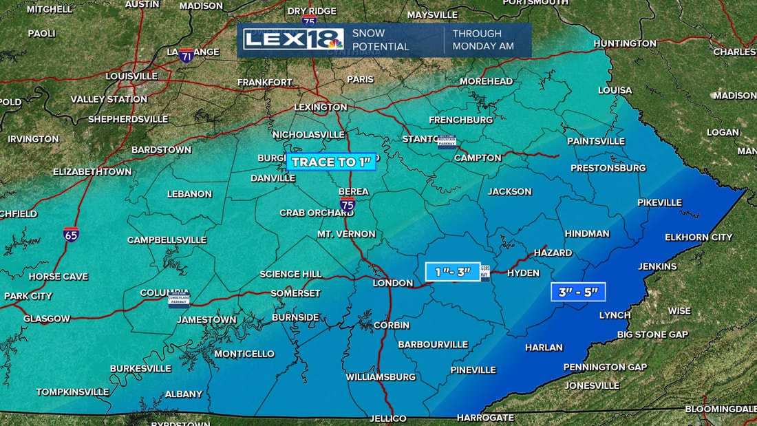 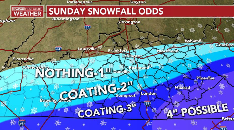 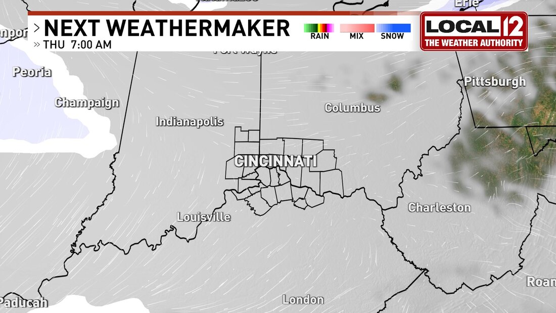 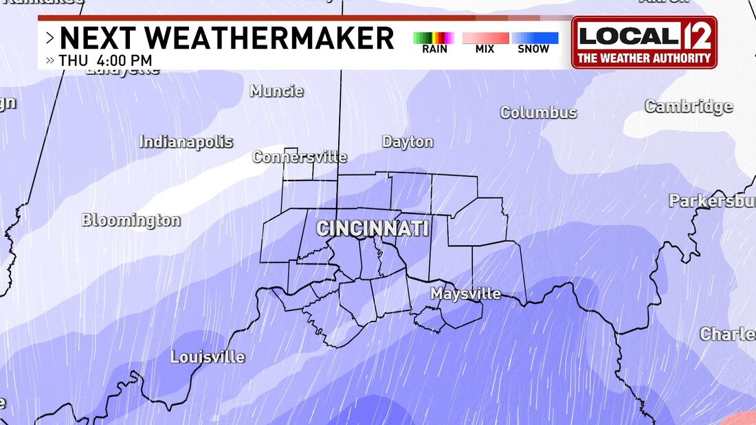 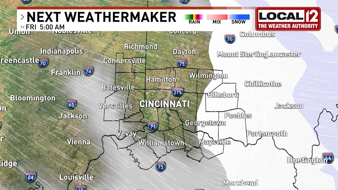 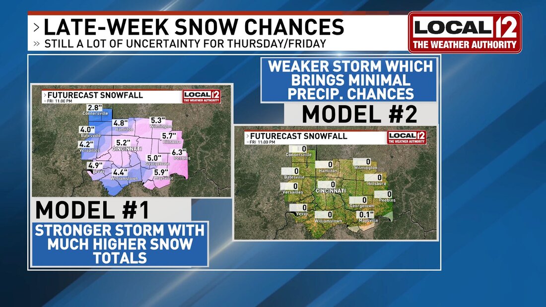 It's sNOw guarantee, but we could see our next chance at accumulating snowfall Thursday and Friday as an Appalachian Runner slips & slides our way. High amt of uncertainty in storm track, intensity & totals. Stay tuned and we'll hammer out details. #CincyWx #BadNewsBrad
@Local12 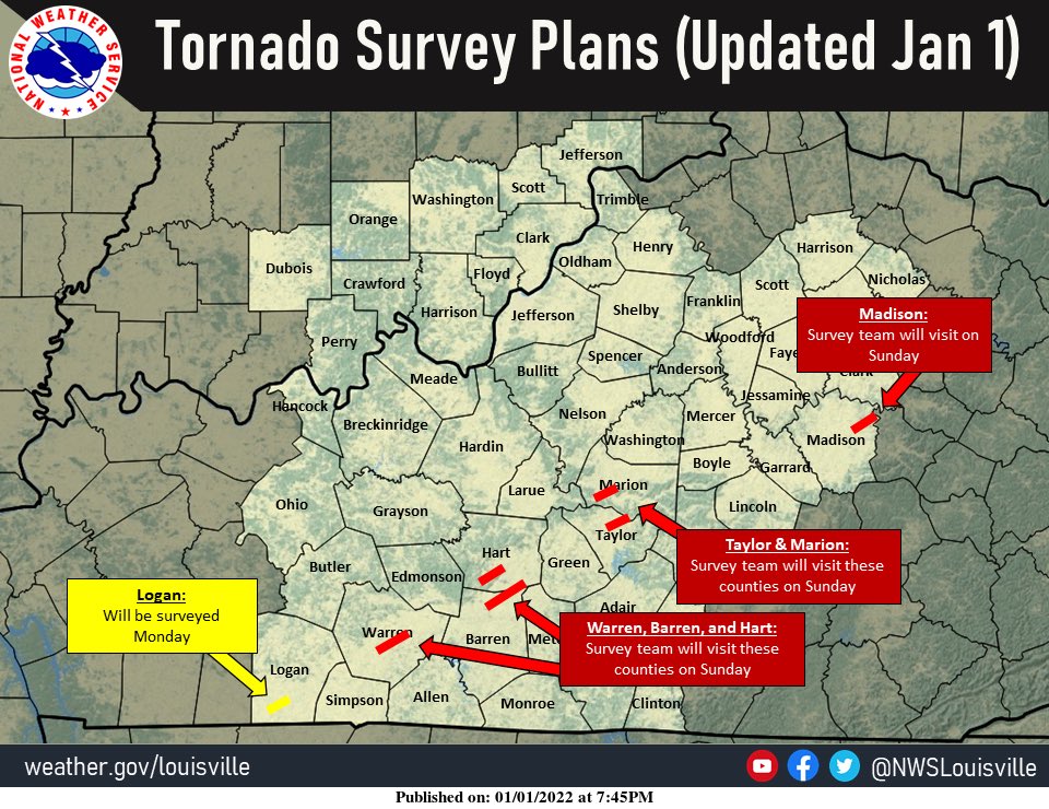 Beginning tomorrow, teams from the NWS office in Louisville will start surveying the damage left behind from today's severe storms. #KYwx
RICHMOND, Ky. (WKYT) - Madison County officials are assessing the damage caused by a storm on New Year’s Day.
A tornado warning was issued for part of Madison County just before 2 p.m. Saturday. Some viewers told WKYT they saw what they believed to be a funnel cloud in the sky around that time. “It was crazy coming through here. The trees were down, everyone was out here. I had never seen anything like this,” said Olivia Goode, whose home was damaged in the storm. In Union City, Goode looks around at the mess that is now her front yard. The massive tree uprooted in the storm barely missing her home. “We always talked about if there was a tornado or anything to come through here, that was the tree we were so afraid of. It was only like five feet away from hitting the house, so we’re very blessed.” Goode and her family sought shelter at with a neighbor right before the storm hit. As she takes in the scene, she can only consider herself incredibly lucky. “We’re very thankful. There’s no serious damage to the house, just the roof and some water damage. So we have a lot to be thankful for.” Fire Chief Robert Eades said the storm came in fast. “I know it wasn’t but three or four minutes after the sirens went off that it hit. A neighbor called me and told me to come to his basement. Before I got out the back door, it hit. Just right after the sirens. So it was real quick,” said Chief Eades. Eades joined homeowners in the community, assessing the damage, cleaning where they can and figuring out where to go from here. “We just kind of have to wait and see.” The Union City Fire Department tells WKYT several homes in the Union City area have damage. Firefighters also say some barns have been destroyed by the storm. At one time, fallen trees and branches were reported to be blocking parts of Wilderness Road, Walker Parke Road, Brookstown Road, and Union City Road. Firefighters say the debris has since been removed from those roads. No injuries have been reported in Madison County because of the storm. Copyright 2022 WKYT. All rights reserved. |
AuthorEverything you need to know about the weather right here, with each post we will keep you up-to-date with all the weather. Archives
January 2023
Categories |
 RSS Feed
