|
Good Morning. Yup, you read that right, we have another storm or Winter Storm maker coming in later mid week. I don't know about you, but I am done with all this weather! Here are some thoughts on the setup ahead:
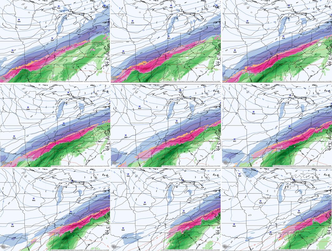 EURO continues to be the coldest of all the models and brings significant amounts of snow and ice into the region… The latest Canadian Model is very concerning as it continues to put down a tremendous amount of precipitation in our region, especially freezing rain… 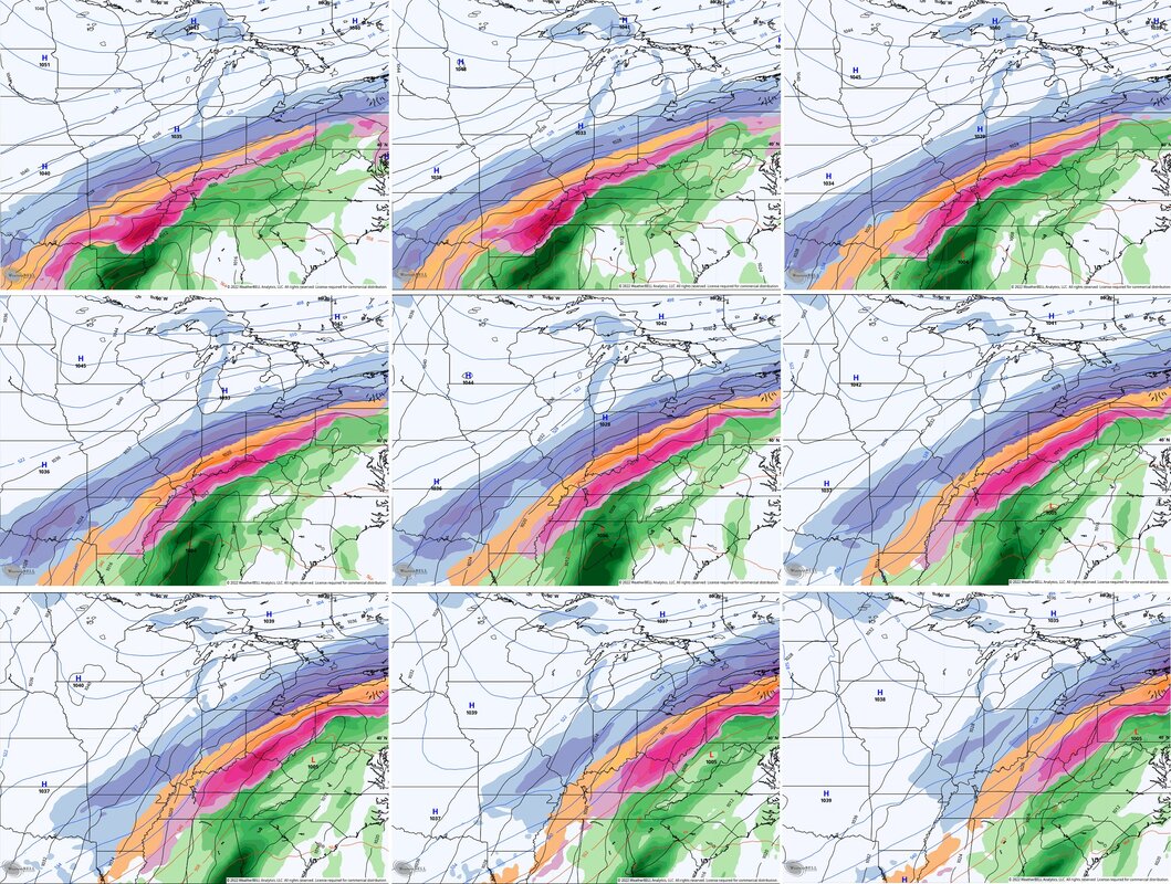 These are from Chris Bailey's blog. Just repeating the best. He knows this stuff. We will keep you up-to-date with this as more come's in.
0 Comments
 Here is what we know as of right now, there is a little of snow on the ground here in Lexington, and more to come through-out the day today. Other areas will see more. See above. 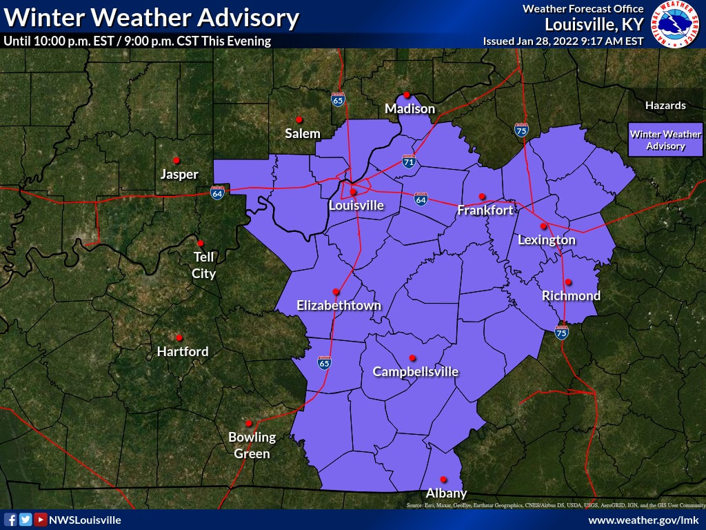 As you can see, there is a Winter Weather Advisory in effect till 10 EST Tonight. We will keep udating right here with more. Take care out there and everyone.
 Good Morning,
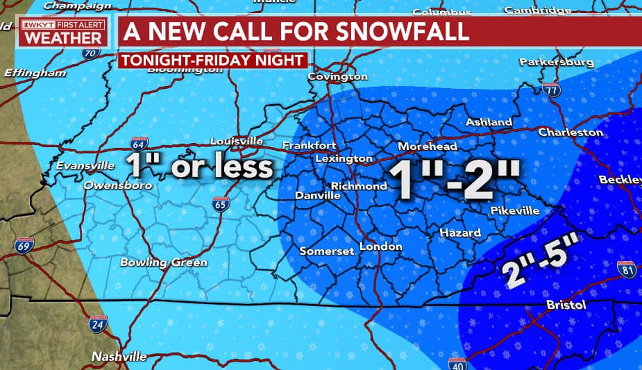
Looks like our Second storm of the week, came and gone and just like that, another one is on the way for next week. This is what winter is all about, but it's nothing like 1994's storm where we were rendered helpless and stranded day's on in. I know right? I remember that one still. But just for today we will not be getting above the freezing mark. Sunshine looks like it's here, but don't know if it's hear to stay or not. The next few day's we are in a freeze and not getting out anytime soon. Soon as they start posting about the next storm, we will be right here posting it. Until then, please take care and take care of one another. Red Vinyl 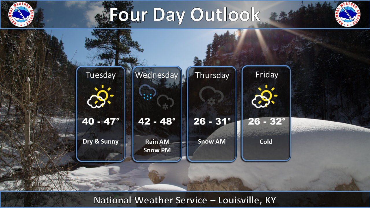 Good Morning, We JUST got through one Winter Storm, now we are heading into another one. Now, with this one, it seems like everyone is in line of agreement on the amount we will get getting. As always we will be updating you as we know more on this storm. Here is what we know about this next system: 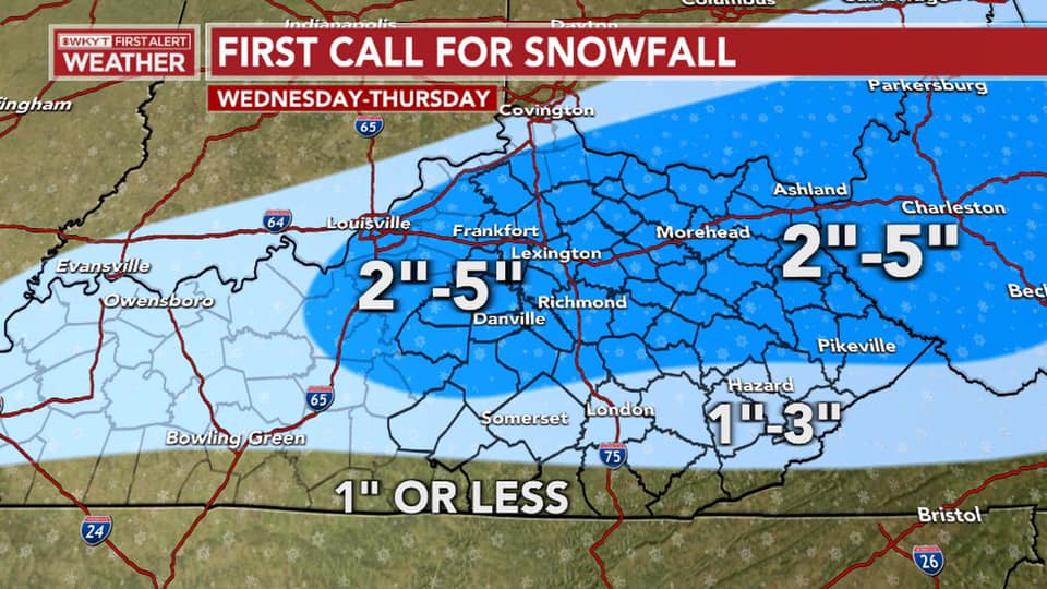 As you can see, this is just the First Call of snow. Credit from WKYT. They have been next to right about all these storms thus far. But Here is what NWS, WCHS, WYMT have to say about these storms too. They get all the credit for this. I am just sharing the news. 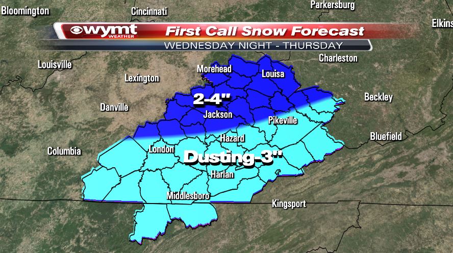 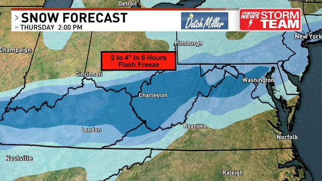 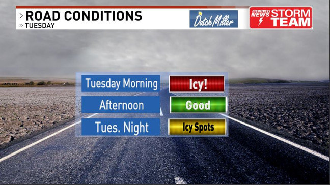 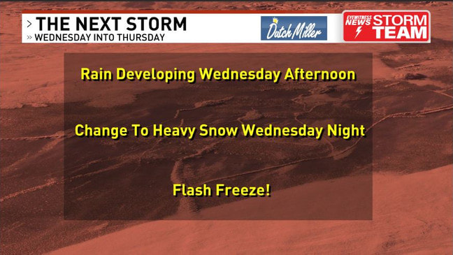 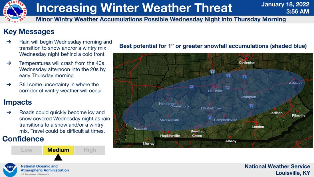 As always, we will keep you up-to-date with all this as the storm unfolds. Keep safe out there and check on your older neighbors as much as you can. Thank You, have a great day.
-Red Vinyl 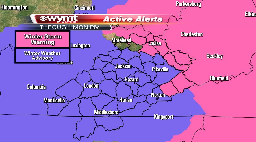 Good Morning, Here is what we know this morning. New: Most of the Winter Storm Warning has been replaced with a Winter Weather Advisory that goes through noon or 4 p.m. Monday, depending on where you are. I think that for the most part ours here in Lexington will expire at 9AM EST. We will update our blog as needed if there is more to come. 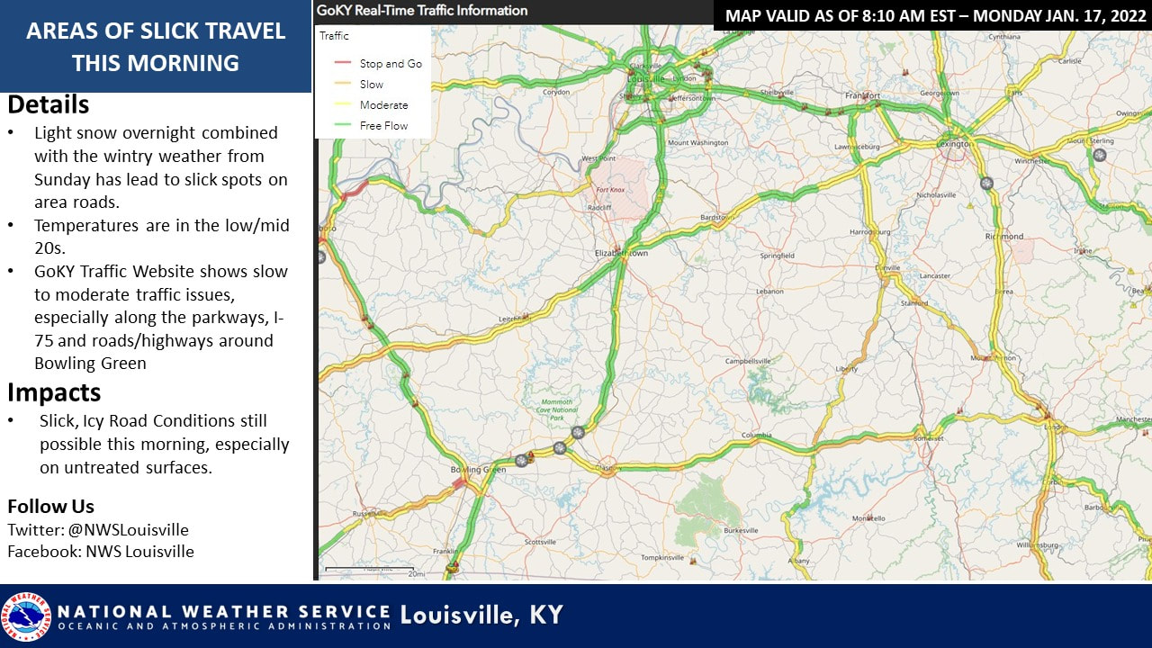 Here is the map of travel, just released 3 minutes ago. 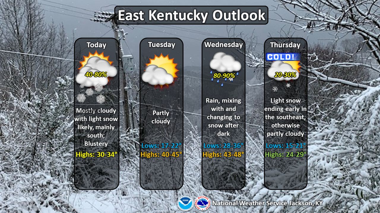 UPDATE 10:30 AM EST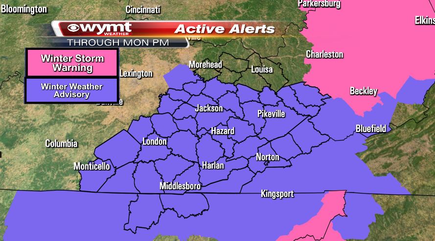 New this morning: NWS has replaced all of the Winter Storm Warning with a Winter Weather Advisory or just canceled it altogether. They end at different times this afternoon with the higher elevation counties going until 4 p.m. UPDATE AS OF 12:10PM EST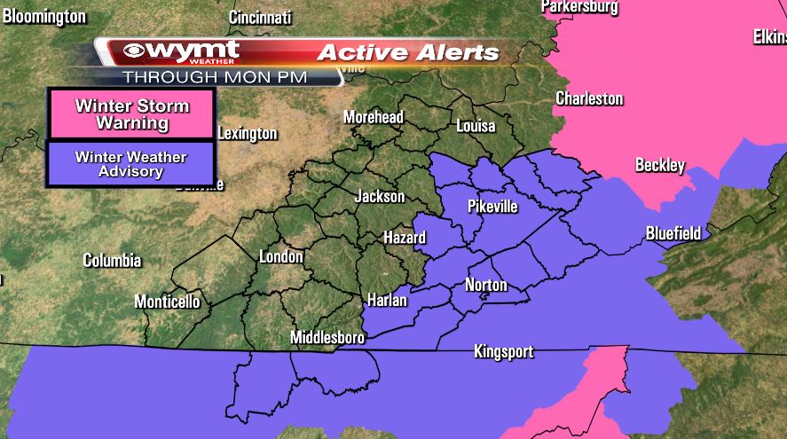 Good Afternoon,
The NWS in Jackson is canceling more of the Winter Weather Advisory. This is the current watches as of 12:10 PM EST. 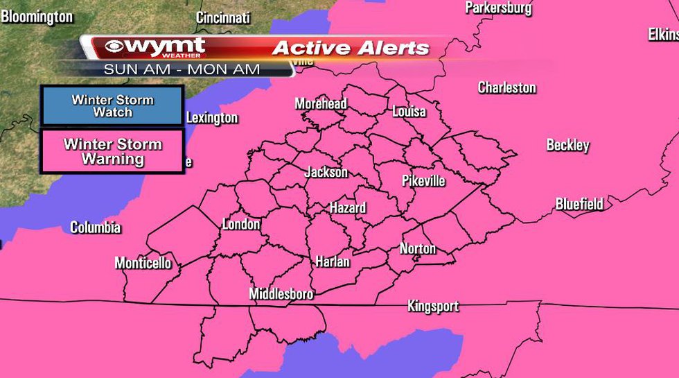 Good Morning, looking about the same since our last post here, but I hope that you all got your Milk and Eggs and Bread for the next few days for the areas that are seeing more than 4'.    This was updated this morning about 3 hours ago, and kinda looks the same. Just remember there will be ICE with this storm through-out the run. Please, if you don't have to be out, don't be. Please take care out there and help one another.  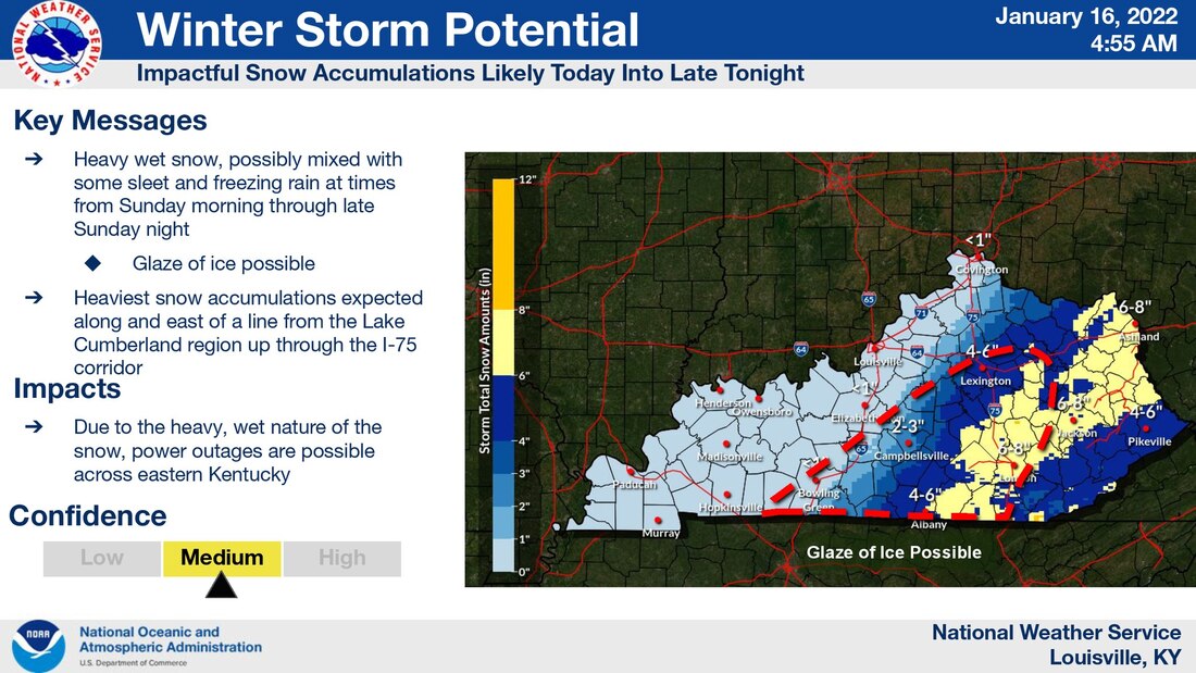 The WINTER STORM WARNING is still issued for much of our listening area until 4:00 a.m. Monday morning, January 17th. The National Weather Service says any snow could fall at a rate of 1 inch per hour. We'll keep following the weather throughout this Sunday! •WHAT: Heavy, wet snow is expected, and could be mixed with rain and freezing rain at times today. Total snow accumulations of 4 to 7 inches, with locally higher amounts possible. Ice accumulations of a light glaze up to one tenth of an inch UPDATE AS OF 10 AM EST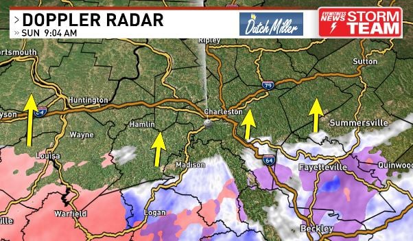 This is the latest of the storm tracking right now. Coming straight up the state as you can see. We will keep you up-to-date right here with the latest. 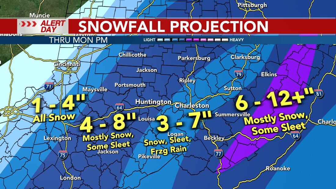 As you can see, there is still kinda a difference in the amount of snow we will get from different stations. I don't know what to feel here. Not a good thing when everyone can't agree on the same thing..  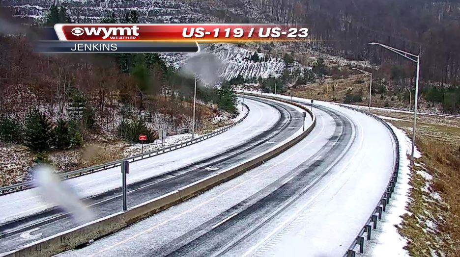 As of right now in Jenkins Kentucky. It's here people. Starting to do this again early... Please, if you don't have to be out, don't be and check in on your neighbors. UPDATE AS OF 5:30 PM EST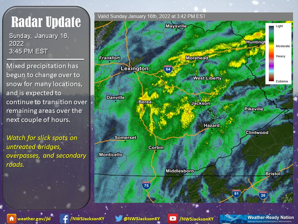 Good Evening, Here is what we know at this time, the mixed precipitation is now all snow at this time. Remember, if you don't have to be out, don't be. Transportation cabinet has asked if you don't have to be, don't be. Road closures will begin shortly as the storm begins to hit harder later this evening. We will keep you up-to-date right here. Keep safe out there and help one another.  UPDATE AS OF 6:05PM EST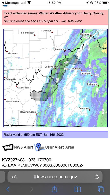 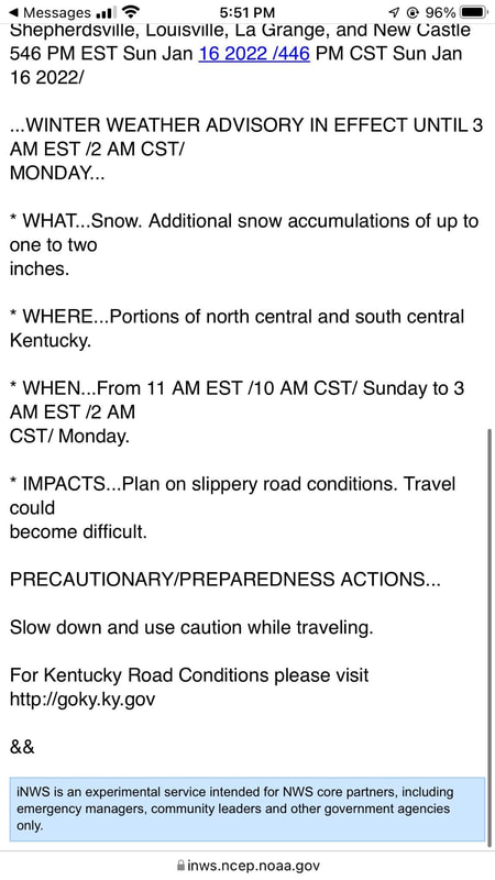 Good Evening,
There is ICE coming down on the I75 marker, please don't be out in this area if you don't have to be. This is getting real, real fast. Please take care out there. 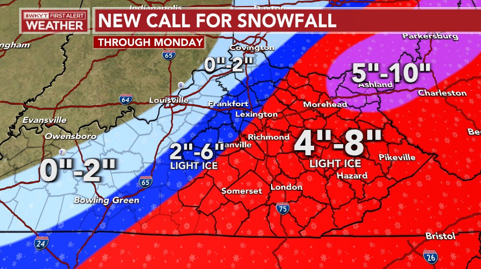 Good Evening, Here is the latest on the snow totals that was just updated a few minutes ago from WKYT Weather. I am sure that this will see another change before the storm hits. We will keep you up-to-date when the news comes in. 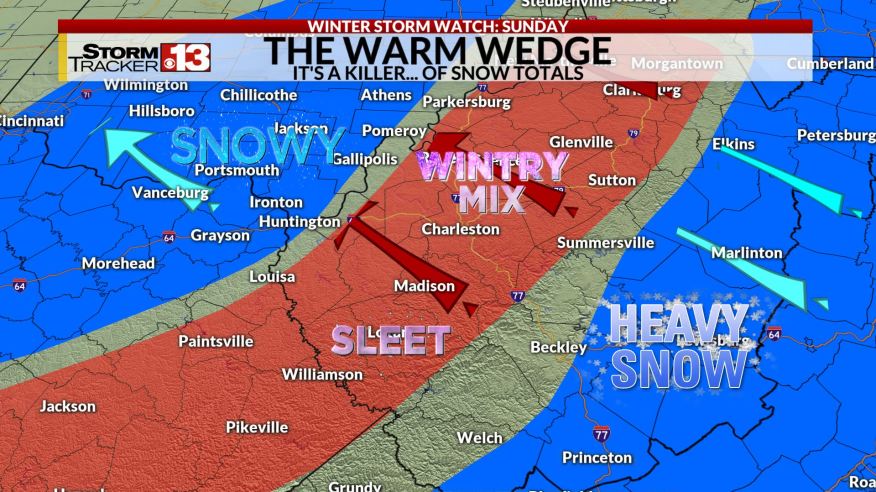 This one is from WOWK TV and as you can see they are not matching up. I will tell you this, when they don't start to line up, you better believe that the storm is going to dump more. 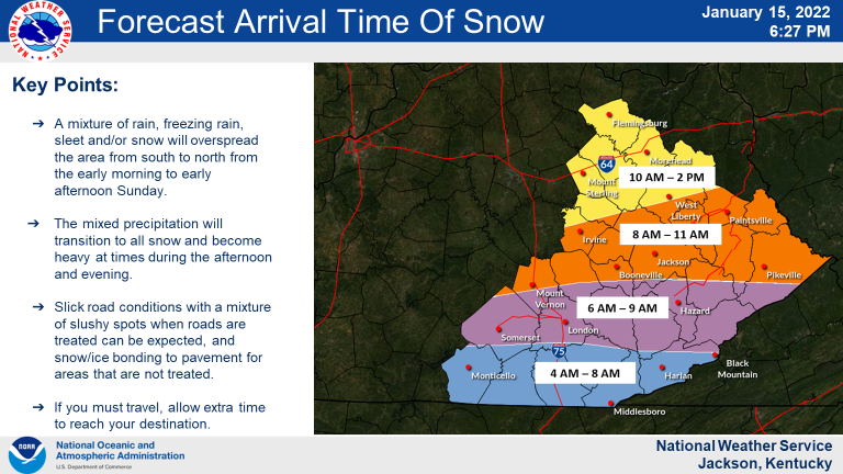 Here is the time for the storm.. 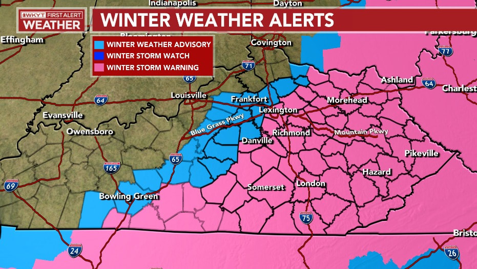 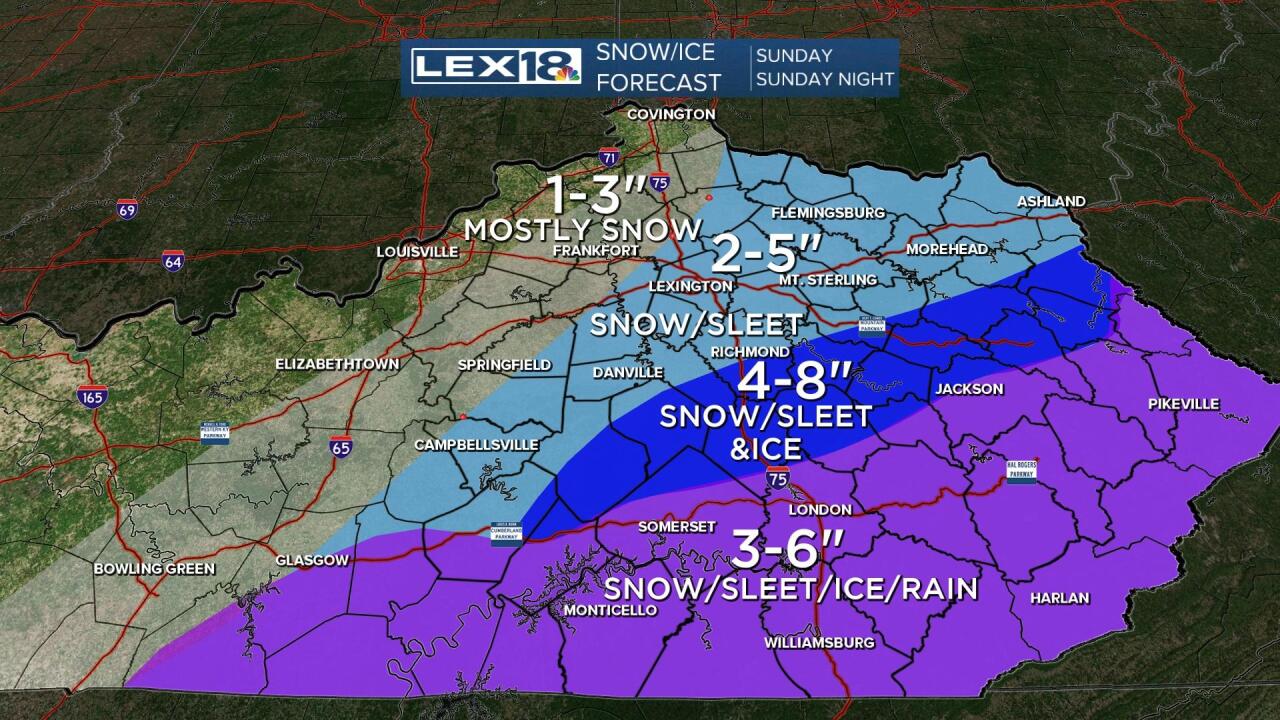 Again, we will keep you up-to-date with all the storm, when there is more to report. Keep safe out there and take care of each other.
 Good Morning, As of 7:20 AM EST we are still under a Winter Storm Watch. I feel this will be upgraded to a Warning soon. People have been giving their first calls for the snow and we will list them here, and update through-out the day, right here. 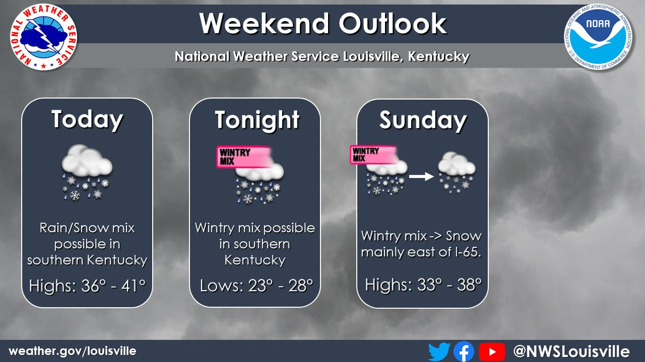 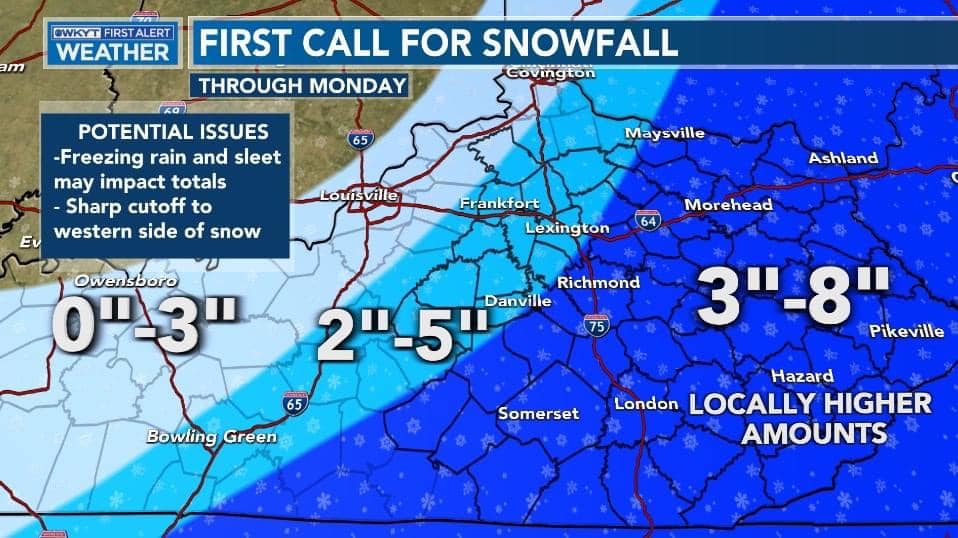 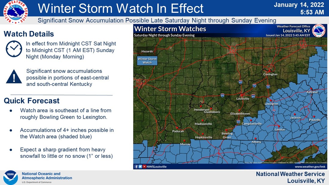 Please be safe out there today and tomorrow, and just understand what a Watch and Warning's are. Keep safe out there and see you later.
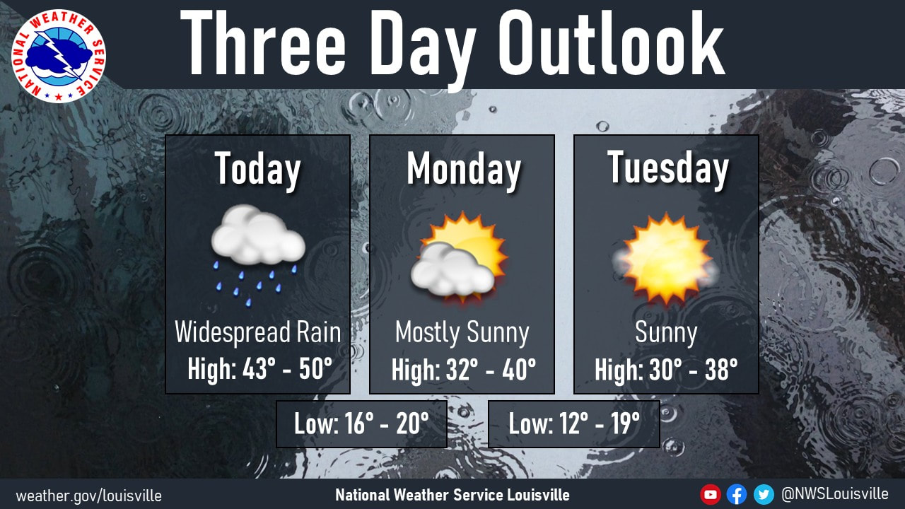 Good Morning, Looks like we are still getting more rain before it's done. Looking ahead at the week, Sunny Sky's will return but the temp don't reach but the upper 30's on most day's and the teens at night.  As you can tell, there is more rain to come before it's all done with today! Then we will have to deal with the rain turning into Ice later tonight with the temp just being 17 degrees. 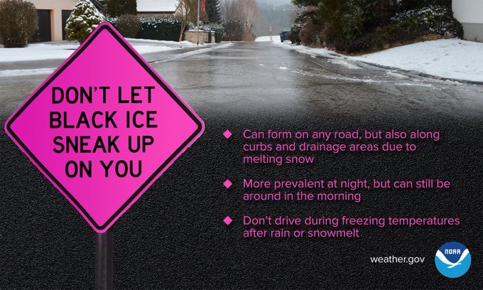 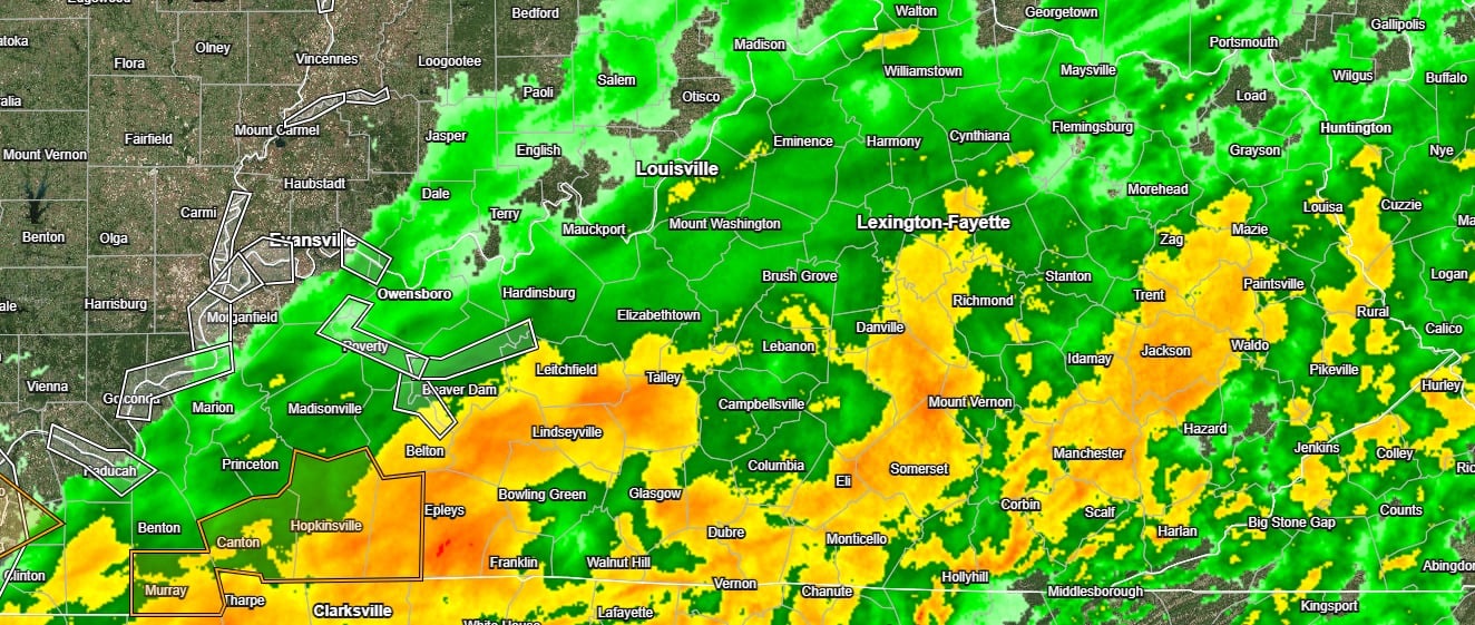 As of 11:30 AM EST. Please, if you don't have to be out, don't be this evening. Please take care out there and help a few stranded neighbor.
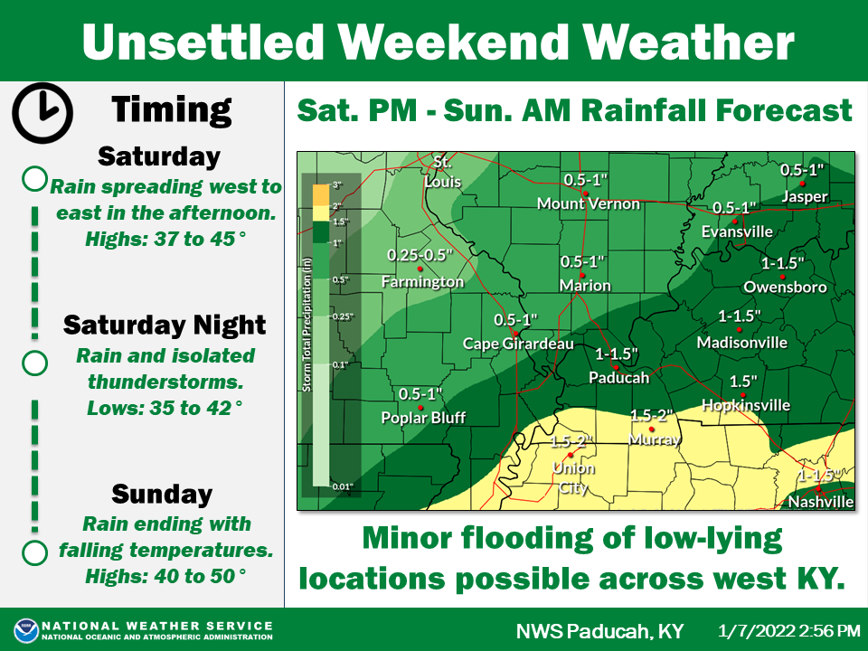 Good Morning, The rain is on the way for tonight and into tomorrow! Flooding is the main issue for the moment with all the snow on the ground. Keep tuned here for more as we update you. UPDATE: 3:20 PM EST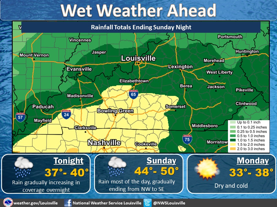 |
AuthorEverything you need to know about the weather right here, with each post we will keep you up-to-date with all the weather. Archives
January 2023
Categories |
 RSS Feed
