|
Mostly clear skies, light winds, and dry conditions are on tap for the residents of eastern Kentucky today and tonight. A passing, albeit weak, cold front will push through the area Monday and Monday evening, bringing isolated showers and storms to eastern KY. Dry and warmer weather is expected for Tuesday, as high pressure settles back over the region. 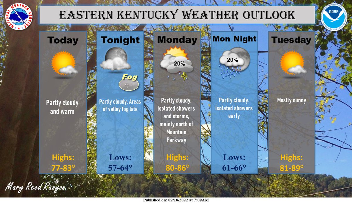 A round of record breaking heat is expected to build across the area for the first half of next week. A very strong high pressure ridge will limit any precipitation chances and most places will see very limited cloud cover for any sort of relief. Be prepared for the upcoming heatwave and be sure to check on family members, neighbors and pets as the heatwave gets underway!  Have the best rest of your weekend and take care of each other too.
0 Comments
A slow moving upper level disturbance and frontal boundary will bring several rounds of showers and storms through the extended weekend. Here is the current rainfall outlook, with isolated instances of flash flooding possible through Labor Day. 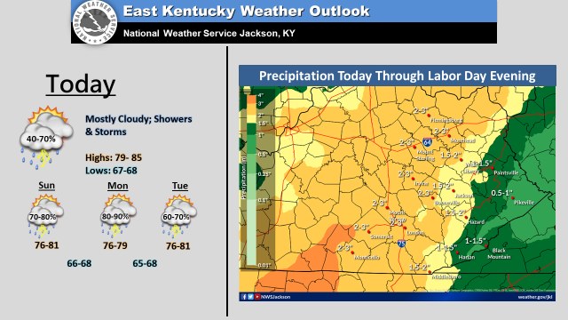  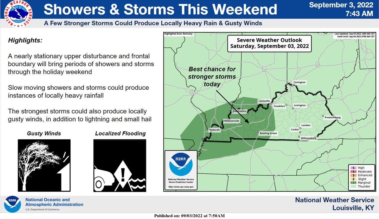 Have a great weekend out there and take care of each other.
|
AuthorEverything you need to know about the weather right here, with each post we will keep you up-to-date with all the weather. Archives
January 2023
Categories |
 RSS Feed
