|
A cold front will slowly track into the region today. This will bring widespread showers and thunderstorms to the forecast area through early Tuesday morning before high pressure builds in for Tuesday afternoon. 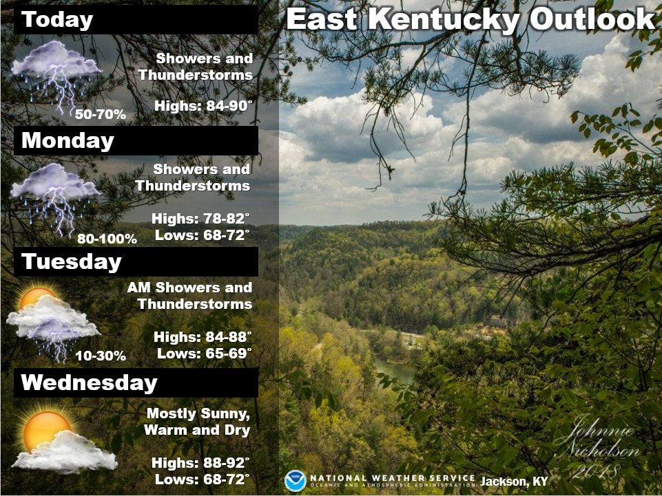 Beneficial rains will spread across the region beginning late tonight and continuing through the end of the weekend. Widespread rainfall amounts of 0.5 to 1.5 inches are expected, with locally higher amounts up to 2 inches possible. An isolated strong storm is possible across SE MO into W KY Sunday afternoon and evening. 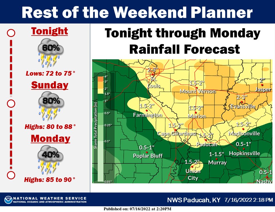 Intervals of showers and storms today and Monday, with locally heavy rainfall possible. Dry but turning hot Tuesday, with 100+ heat index possible Wednesday. 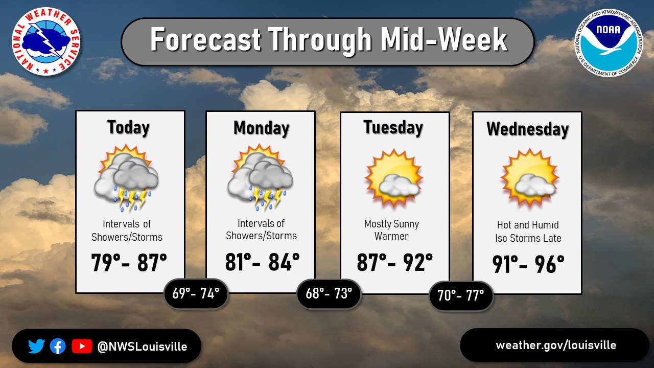 Have a great day everyone.
0 Comments
Leave a Reply. |
AuthorEverything you need to know about the weather right here, with each post we will keep you up-to-date with all the weather. Archives
January 2023
Categories |
 RSS Feed
